Having been thoroughly jabbulated against the plague, the Weazel and Dr. Ann set out on a late springtime trip to the southern Cumberland plateau which extends throughout much of Tennessee, then into adjacent Georgia and Alabama.
By leaving in mid May we were too late to revel in the ephemeral wildflowers of early spring, but we could at least look forward to warm sun and a balmy breeze. It was not to be, for this is a tale of Blackberry winter.
………………………………………………………..
Some might argue that the famous Lookout mountain which towers over Chattanooga isn’t really part of the Cumberland plateau, but I hereby give it honorary status. Most geologists contend that Lookout mountain is part of the ridge and valley physiographic province of the Appalachians, but neither Lookout mountain nor the plateau share the characteristics of the much taller Blue ridge and Smoky mountains farther to the east. The Smokies and Blue ridge are “hard rock” mountains primarily composed of igneous intrusions; whereas, the Cumberland plateau, like Lookout mountain, is almost entirely composed of limestone and other sedimentary rocks with a sandstone cap.
From Chattanooga Lookout mountain extends southwest as a narrow linear ridge running through the northwestern corner of Georgia, then down into eastern Alabama. Throughout its length it is only about 2000 feet tall, and effectively flat on top.
The mountain may not be very lofty, but it is rich in history. This was the heartland of the Cherokee. After their removal the entire area was quickly colonized by settlers who soon found a new enemy.
During the War of Northern Aggression the resident rebels realized the strategic importance of a mountain which directly overlooks the Tennessee river at Chattanooga. The Tennessee river was a major conduit for settlers and soldiers headed west, so where better to place cannons to blast the Yankees when they attacked?
Lookout mountain may be low, but it is steep, so steep that when General James Negley decided to attack the rebel positions on the heights he had no choice but to ascend from the backside of the mountain in a place known as Johnson’s crook.
An aside: General Negley was the grandfather of Negley Farson the greatest writer and adventurer that you have never heard of. His book, The Way of a Transgressor is one of the finest books I have ever read. It chronicles his extraordinary adventures as a world ranging journalist in the early twentieth century. I foolishly leant this precious tome to one of my illiterate friends and I haven’t seen it since. If you have it please give it back!
The so called “Civil war” was a big mistake and we deserved to lose, much as the right wing separatists of today deserve to lose. But losing has a positive side, it sets back progress which is the enemy of all. So it was that after the big kerfuffle Johnson’s crook returned to obscurity and stayed quiet and peaceful for more than a hundred years.
The idyll came to an end when real estate speculators discovered Lookout mountain. The damned Yankees were back! The attack was relentless, and soon vacation homes covered the cannon emplacements of yore. Once the heights were fully occupied the disease of development oozed over the edge of the escarpment to infect Johnson’s crook. The previously peaceful valley was envisioned as a hobby farm playground for millionaires. Toward that end roads and lakes were built, and ornate gates proclaimed that only the elect might enter.
Those heady times for bad investments came to a screeching halt in 2008 when the recession hit and the bills came due. The Preserve at Rising Fawn collapsed due to mortgage fraud, the promoters went to the Big House, and the skeletons of half finished pleasure palaces litter the ground to this day.
Into the breach stepped a hero, the Southeastern Cave Conservancy (SCCi) , the single most effective conservancy of which I am aware. The SCCI owns and protects caves and karst features throughout the southeast. They manage their properties both to protect wild areas, and to allow controlled visitation of places that would otherwise be closed due to liability. Ann and I are both proud to be sustaining members of SCCi, and one of the perks is that we can camp on some of their properties!
I have no idea of how the SCCi managed to acquire 2400 acres of prime development land at rock bottom prices, but they did! Perhaps it was due to the fact that the crook is riddled with caves, 49 in the SCCi preserve alone. Banks holding foreclosed properties consider caves to be a serious liability. They have too much to lose. What if little Nellie should fall into the well? Heaven forfend! Better to let crazy cavers assume the risk! So it was that the crooks were expelled from the crook!
As you can see below, Johnson’s crook is immediately east of the euphoniously named Rising Fawn, GA. The crook is a major indentation on the western flank of Lookout mountain not far from the Alabama/Georgia state line. It is immediately south of magnificent Cloudland canyon (more on that later).

Upon our arrival we were dismayed to see the remains of the development, but the crook still retained its bucolic ambience.

There was no good place to camp, so we set up behind a gigantic red barn intended to house the racing stallions of future would be “second homesteaders”. At least the site was flat, and the view up the crook was magnificent, an encompassing wall of green mountains.
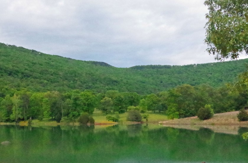
The weather quickly deteriorated. By morning it was obvious that a great storm was coming. I had strongly reinforced my tent with a large tarp, but had placed it too close to the barn. When the storm hit huge sheets of water sluiced off the barn roof, the area flooded, our air mattress went flat, and the wind collapsed our tent. Somehow the tarp held and we stayed dry, but by the following morning the temperature had dropped to the upper thirties. So much for beautiful spring weather, Blackberry winter (cold weather during the time when blackberries bloom) had returned in force!
We began our adventures by visiting friends who live near Frick’s cave on the other side of Lookout mountain. Like Johnson’s crook, Frick’s is owned by the SCCi, but cavers can only visit the entrance due to the presence of a colony of endangered Gray bats within. That is fine with me since I am too damned old to really go caving!

Frick’s cave is located near the site of the terrible battle of Chickamauga. The rebels won, but it was a Pyrrhic victory, for the South suffered 18,454 casualties out of a total of 34,624 men killed or injured. Only Gettysburg was worse. If this is what modern day secessionists want I say their rebellion should be ruthlessly crushed. Let the imaginary God they believe in sort ’em out after we have pried their cold dead fingers from their triggers. Once is enough!
The torrential rain meant it was time for waterfall watching, so we headed to nearby Cloudland canyon.
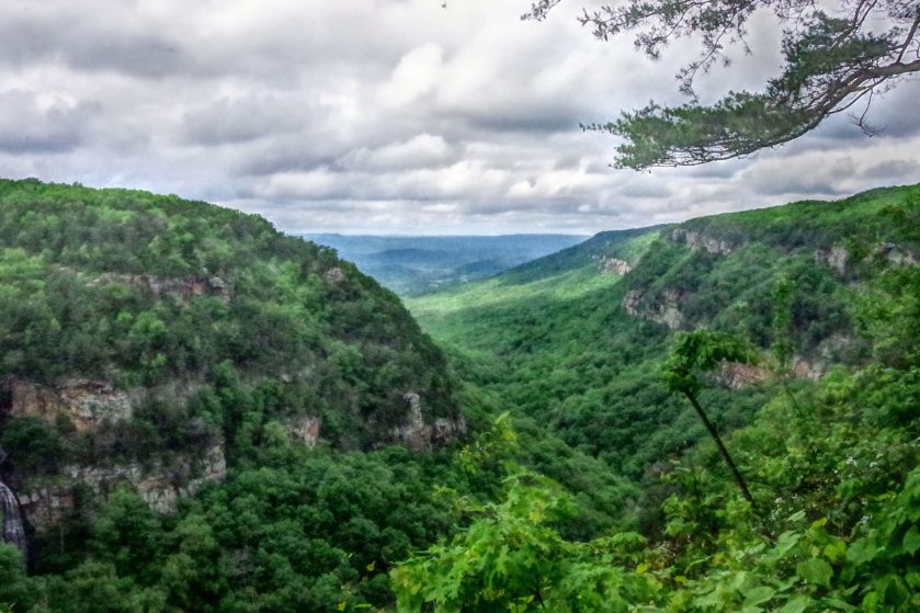
The waterfalls were roaring! First we visited Cherokee falls halfway down the gorge. The trail is steep but good, and besides, we flatlanders needed the exercise to tone up for the arduous hikes ahead.

Below Cherokee falls Daniel creek tumbles through rich forest before plunging over Hemlock falls.

Please forgive me for the photographic sin of shooting these beautiful waterfalls straight on. In the good old days when the Weazel was a pup I used to climb the slopes and even go behind the falls to get a good shot, but now there is an observation deck and signs prohibiting anyone from climbing or frolicking in the plunge pools. Damn that giant rock in front of Hemlock falls!

The forest is virgin at the base of the falls. There were hemlocks and enormous Liriodendrons, erroneously known as tulip poplars. The hemlocks seem to be resisting the dread woolly adelgid that has brought these monarchs of the forest to the edge of extinction elsewhere.
Once upon a time I followed a precarious ledge from Hemlock falls all the way to a distant unnamed waterfall. It was very scary, but now there is an excellent path down into Sitton’s gulch, and even a bridge that had to be flown in by helicopter.

The Sitton’s gulch path continues all the way down the mountain to Trenton, GA, a wonderful walk. At the mouth of the canyon is the enormous entrance to Sitton’s cave. By some miracle the State of Georgia has allowed the cave to remain open to whosoever is foolish enough to enter.
My first major discovery happened the morning after the big storm. It was cold, wet, and drizzling as I trudged through soggy grass on my way to the distant tree line on a matter of urgent personal business. Right behind the corral I looked down to behold the world’s cutest little turtle ambling through the grass.

The elfin creature was black with orange polka dots, and it had bright orange cheeks. It appeared to be ancient even though it was less than four inches long. I immediately presumed it to be a Spotted turtle Clemmys guttata, the first I had seen in many years.
Unfortunately, my mission was urgent and I had no camera. I should have returned to camp to get a photo but I didn’t. Who carries a camera on the way to the toilet? I will never let that happen again!
Back at camp I began to wonder, had I really seen spots? What was it doing in the mountains of northwest Georgia? Spotted turtles are usually creatures of the coastal plain. It slowly began to dawn on me that I was wrong, it wasn’t a spotted turtle that I had seen.
I now believe I actually found a bog turtle Glyptemys muhlenbergii, the smallest rarest turtle in North America, the holy grail of tortugaphilic herpetologists!

Bog turtle distribution is spotty. They are primarily a northeastern species, though relic populations are scattered throughout the Appalachians into the northeastern corner of Georgia. To the best of my knowledge they have never before been found in northwestern Georgia
These delightful diminutive creatures are on the path to extinction due to climate change, but for once it is not our fault. They invariably live in bogs and wet meadows, and are only active in cool moist weather. During the Pleistocene such habitats were common throughout eastern North America, but when we emerged from the Ice age the forests closed in leaving only scattered populations in ever shrinking habitats. The few Bog turtles that remain are threatened by disease and the pet trade, and as a result they are protected under the Endangered species act. I wanted to keep the damned thing myself but came to my senses in time!
This wonderful discovery highlights the importance of conservation properties such as those owned by the Southeastern Cave Conservancy.
Over the following several days the weather improved slightly but the nights remained frigid, and highs were only in the mid 60s. A cold night followed by a cool but sunny day is perfect rattlesnake weather!
So it was that Ann was walking ahead of me on the Two pond trail when she suddenly froze. I could tell by her posture that it was a snake, and a fine snake it was!

In the good old days the Weazel would have disdained the Common toad as being too common; but now, in the latter days of the biological apocalypse, I realize what wondrous creatures they are.

The only other amphibians of note were the ubiquitous Slimy salamanders which could be found under almost every rock.

All salamanders other than newts are a bit slimy, so why is this species called THE slimy salamander? Notice that the little fellow looks a bit roughed up. That is because I had to catch it to photograph it. As a result my hand was covered with a layer of slime that took three days to remove even with soap and water!
Wherever there are salamanders their foremost foe awaits, the deadly Ringneck snake!
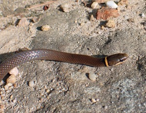
The ringneck snake is indeed deadly, but only to salamanders. I know this because I have twice seen salamanders that have been bitten rush frantically into open sunny habitats, something neither species would normally do, then promptly die with the ringneck in hot pursuit!
Let me remind my gentle readers that all of these animals are protected in the state of Georgia, and the Bog turtle is federally protected. Aside from that, should anyone attempt to enter an SCCi preserve to collect these protected species they will be shot on sight!
So much for the herps of Johnson’s crook, but what of the lovely flowers and their attendant butterflies? I am sad to report that there were few of either. Other than common roadside weeds there were few indigenous species blooming in mid May other than Mountain laurel and the ubiquitous Maple leaf viburnum.


(Sorry for the bad photo of the Viburnum, it is excessively white, but that is the fault of my camera which has an implicit bias toward reality.
It was interesting to note that almost all of the flowering plants were growing immediately below the top of the plateau and nowhere else. It would be easy to explain this as the result of climate change, the cool weather species are retreating up the mountain as the climate warms, but I think something even worse is happening. I believe the lack of flowering plants is in great measure due to the collapse of the pollinator guild of insects that have fallen prey to invasive exotic diseases that preferentially attack temperate zone species.
But what of the 49 plus caves in the preserve? We found several during our daily wanderings, but our permit prohibited entering any of them. That was OK with me! Here is the entrance to Gypsy cave which is 268 feet deep.
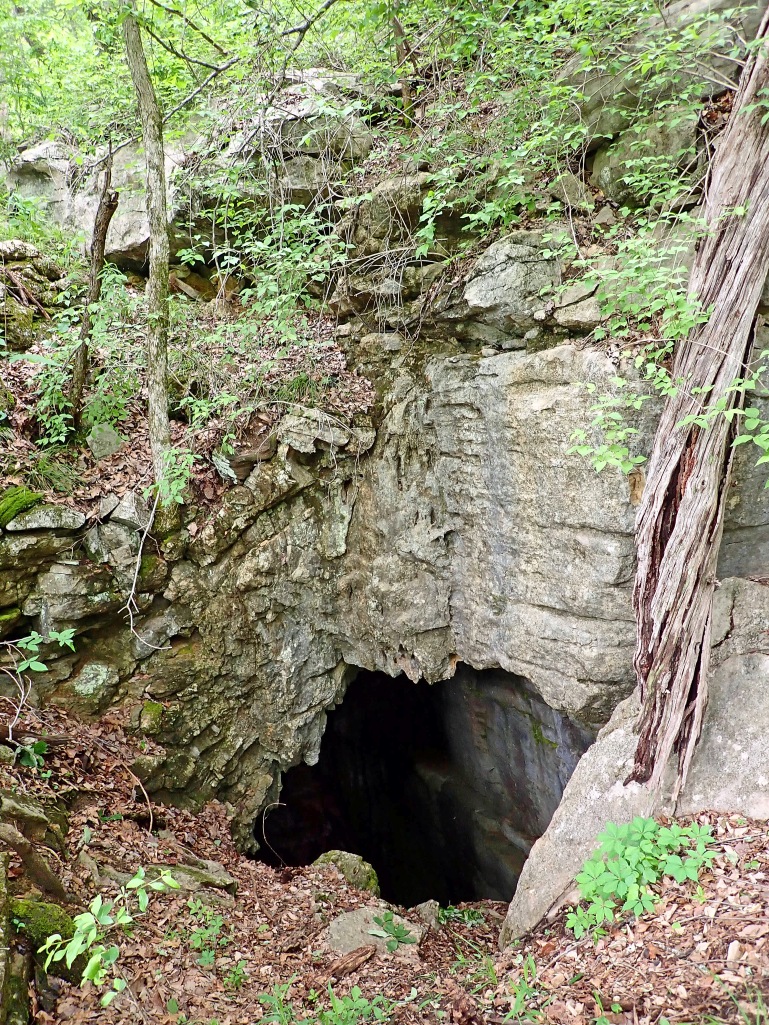
Our days as cavers may be effectively over due to old age, but we are not too old to hike to the entrances!

Stay tuned for adventures in Tennessee where we visit Savage gulf and discover an ancient railroad tunnel!
Outstanding, as usual. Thanks for the photos and the insights. Oh, and I immediately purchased a copy of Negley Farson’s, “The Way of a Transgressor.” They are available through abebooks.com
LikeLike
As always, THANK YOU for sending me a copy.
Larry E. Matthews
NSS #6792-F
LikeLike
thanks— the photos and the sites are bee-you-ti-ful!
LikeLike
The deadly ring neck snake!
LikeLike
Always good to hear some else freeze their ass off camping.
LikeLike
Bounce (pits) while you still can! (from ‘Dance while you still can’ sign @ the ol’ Kickin’ Devil in NE G’ville).
LikeLike
Thanks for sending! And now I know who I spoke to on the phone…Dr. Anne!
LikeLike
As usual, an enjoyable and informative trip report.
Thanks for the geology lesson.
Betsy and I were in the same area mostly for eatin’ drinkin’ bikin’ and hikin’.
Our first time there and we enjoyed it.
See: https://EpicRoadTrips.us/2017/35th_anniversary/chatt3-4/
You say:
“…the Southeastern Cave Conservancy (SCCi) , the single most effective conservancy of which I am aware.”
Have you not heard of the Nature Conservacy?
WV-Mike
LikeLike