By late May of 2021 the brief Blackberry winter we had enjoyed atop the Cumberland plateau had given way to sweltering summer in the lower latitudes, by which I mean just over the Alabama line. We packed up, bid vaya al Diablo to our friends at Caver’s paradise, then headed to nearby Huntsville for some urban camping.
Urban camping? How is that possible? The National Speleological Society somehow managed to purchase an extraordinary 94 acre mountainside property directly overlooking the city of Huntsville, and members are welcome to camp there. It is a beautiful place, heavily wooded, pocked with caves, and offers all the civilized amenities one might wish. It was odd to be camped in what seemed like a remote wild place, yet be subjected to the roar of rush hour traffic.
The city of Huntsville is a bit of a disappointment. One might suppose that a small isolated city populated by the spawn of German rocket scientists would be an intellectual haven, and that the decadent grandchildren of the Blitzkriegers would have created a vibrant counter culture; but no, the place is as dull as a suburban strip mall. That’s what happens when engineers inbreed, instead of tie dye their offspring wear pocket pen protectors.
Huntsville may be dull, but it is located in a wonderfully green and forgotten part of the world, a place where, as Faulkner said of the South, “The past is never dead. It’s not even past.”
There is no better place to enjoy the living past than the beautiful Paint rock river valley, an obscure tributary to the Tennessee river. I first went there in 1967 on my way to California to play Hippie during the Summer of Love.
On that memorable day my future ex wife Lema and I joined a group of older cavers for a 4×4 expedition up the Paint rock river and Hurricane creek to the legendary Walls of Jericho, a wonderful place right on the Alabama/Tennessee line. There is no road to the Walls of Jericho, so we had to drive up the almost dry river bed. If I had tried to take my Mustang the rusting carcass would still be there today.
When the river bed became impassable we started walking. An hour later we arrived at the beautiful blue pools. To my surprise and consternation everyone took their clothes off and jumped in. I was chagrinned, for Lema and I were too shy to be naked in front of each other. Though in love, we were still kids who had not yet even kissed! Being in California during the Summer of love soon cured that problem.

I’m no longer shy, and will happily show my hairy ass to anyone, but I am still embarrassed that the short climb up the little waterfall shown above defeated me. All the other cavers did it with no problem.
54 years later Dr. Ann and I headed up the Paint rock river to Estill fork, a tiny community frozen in time.

That’s all there is and there ain’t no more! The inhabitants have yet to be informed that certain subjects have become taboo.

Outsiders (that would be you!) often consider the inhabitants of north Alabama to be living fossils. It turned out to be true!

Not far from Estill fork there is an indentation in the edge of the Cumberland plateau called Hinshaw cove. It is within the Skyline management area, and thus public property.
The Skyline management area is sparsely populated and full of deer, so I have often thought it would be a good place to reintroduce panthers, but the Bubbas, who imagine they are already out there lurking behind the trailer, would shoot them on sight. “If there ain’t no panthers out there then how cum my dogs bark all night?”
The cove was first recommended to me by a wildlife biologist who said the place was full of caves and crawling with rattlesnakes. I have yet to find either, other than a blowing spring with a nasty wet crawlway, but the cove is a great place to search for history untrammeled by archaeologists and other such historical revisionists.
On my first trip to the cove in 2010 my first discovery was a stone mausoleum deep in the woods.

The mausoleum is relatively recent. It was built in 1917. Apparently many previous generations of Hinshaws were re-interred there. What look like windows are actually memorial plaques, most of which use the old English word “borned” instead of “born”. It was built in honor of one of the original settlers, Sister Susan Robertson who was born in 1809, and died of the flux in 1860. Looters, probably local hunters, have removed all the remains.
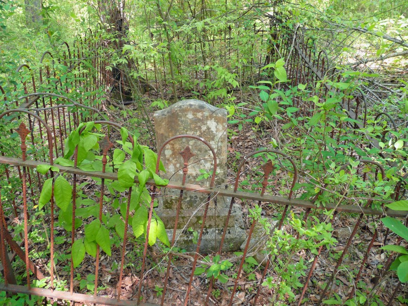
Nearby were other graves, but I couldn’t read the inscriptions.
No settler could live without a well, spring, or running stream. This is karst terrain, so rain sinks directly into the ground to reemerge far away. These ruins were not in the bottomlands near water, but rather halfway up the mountain. That meant the only hope was to dig a well through solid rock.

This may not look like a well, but it is. The hole in the center is obscured by vegetation.

It was customary in those days to build a wall around the well to prevent surface water from polluting it, and perhaps to prevent a wandering cow from falling in. As to a hapless possum, the woeful owner could tell by the smell and somehow pull it out, or just get accustomed to it. A friend of mine once had two dead racoons in his well and lived with it for two weeks until he decided to investigate. He wasn’t unduly bothered because he only drank beer.

No dead possums, just a mouse, but where is the water? I have found many such old wells in the mountains, but none of them had a drop of water. The fact that organic debris accumulates in the bottom doesn’t explain anything. A more likely explanation is that the ground water levels were much higher a hundred or more years ago. It is an inescapable fact that human activity is turning our once green land into a desert. As I write this forest fires are raging throughout the world.
There were other interesting ruins such as the Tiltin’ Hilton. Milled planks and a tin roof show that this building isn’t ancient, just dilapidated.
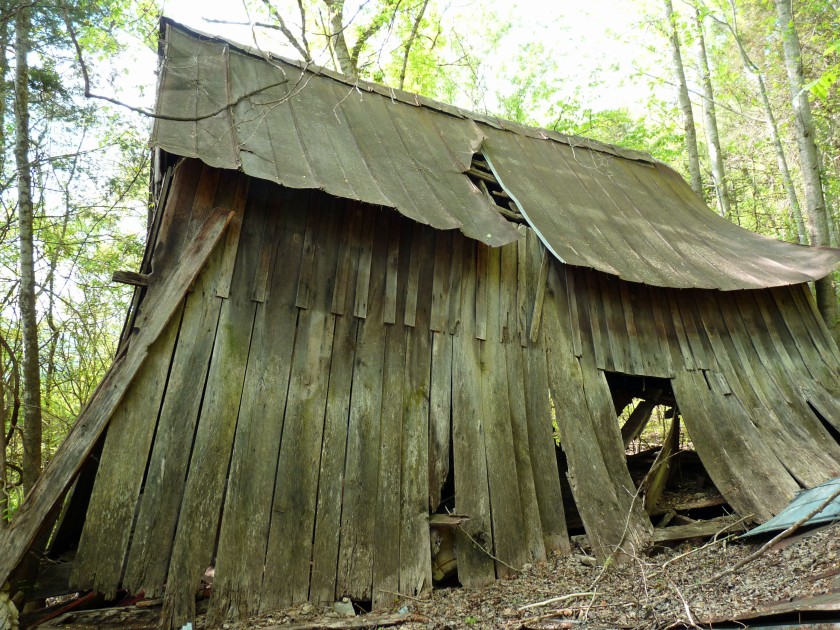
Here is a good example of a much older ruin from a nearby cove. It is still standing because the original shake roof was replaced with metal.

This ancient cabin is the real deal, massive adz hewn timbers with dovetail joints and rocks for chinking. It is probably around 200 years old.
Inside, the person who was presumably the last inhabitant left a touching memorial to all that is good and true. I’ll have to admit that it made me misty. It also made me feel old, for young Samuel was born the same year I was.
When Ann and I returned in May of 2021 nothing seemed to have changed except that the huge old barn at the mouth of the cove was even more lavishly adorned with Virginia creeper.
We searched for the old mausoleum, but couldn’t find a trace. I’m sure it is still out there somewhere slumbering in oblivion.
I easily found the old well, which is flagged in the image below. The topo shows an old cabin at the same location. At first I searched in vain, then discovered I had been standing on top of it. Nothing remained but the vague outline of an old foundation deeply buried in leaves. Sic transit historia.
Previous exploration had taken me southeast to the head of the cove; so, this time we decided to bushwhack northeast to find other old cabins at the mouth of Anderson cove.
We followed a barely discernable trail leading straight up the mountain to a flat, then descended steeply to the north and discovered an old road not shown on the topo that skirts the flank of the mountain, then down to several old cabins along Hurricane creek. (The Paint rock river starts where Hurricane creek and Estill fork converge.)
The old road disappeared altogether, so we had some difficulty finding the first cabin. It too had disappeared, burned up in a fire, but the scattered debris indicated that it was a fairly recent ruin, perhaps abandoned in the sixties. The only structure still standing was a triple seater outhouse.

The family must have been very close, so insert your favorite inbred Hillbilly joke here.
The going was rough in the bottomland. Well named Hurricane creek showed extensive signs of catastrophic flooding that had completely eradicated the old road and left behind piles of flood debris, all entangled with thorny Smilax vines.
Again I searched in vain for the old cabins shown on the map, then finally found pitiful remnants that looked more like a Mayan ruin than an old homesite. The foundation was only about twelve feet square. Be it ever so humble.
………………………………………..
Our Blackberry winter trip had been a great success, but it was time to head home. Needless to say we took the longest slowest possible route through central Alabama.
I was eager to revisit the Wadley rock, an enormous granite pluton east of the Blue ridge mountains in a place where there are few other rocks. You will never find the Wadley rock on a map. Even a careful perusal of a topo map gives no indication of it’s existence, for the rock is nearly flat.
I have no idea how old the great rock is, but consider this: Granitic plutons are usually teardrop shaped. They rise slowly from the mantle over many millions of years, and would turn into volcanoes if they could reach the surface, but they often can’t because they are held down by the overburden of what were once some of the world’s oldest largest mountains. Plutons cool slowly, and thus form granite rather than blowing their top. Stone mountain near Atlanta is a good example of a granitic pluton. Think pink in the image below.

The Appalachians are some of the world’s oldest mountains, about half a billion years old, and were once taller than the Himalayas. Those once enormous mountains are now gone, and the Wadley rock is all that remains, and even it has been worn down to a peneplain.

I found the rock entirely by accident in 2004 while exploring the backroads of Alabama. The first thing I noticed was that the vegetation had changed. Instead of lush temperate forest there was just barren scrub with tortured looking dwarf trees growing out of what looked like polished pavement.
I screeched to a halt and jumped out of the car to discover a fairyland. Other than the gnarled oaks, cedars, and pines, every plant that I saw was new to me, and perhaps even new to science! All of the plants were diminutive, and the most interesting one of all was nearly microscopic.
I’m chagrinned to say that I lost my photos of that extraordinary day, apparently I had arrived at exactly the right moment to witness a fleeting phenomenon, so photos from later trips will have to suffice. These are the best ones I’ve got. None of them fully convey the strangeness of this wondrous place.
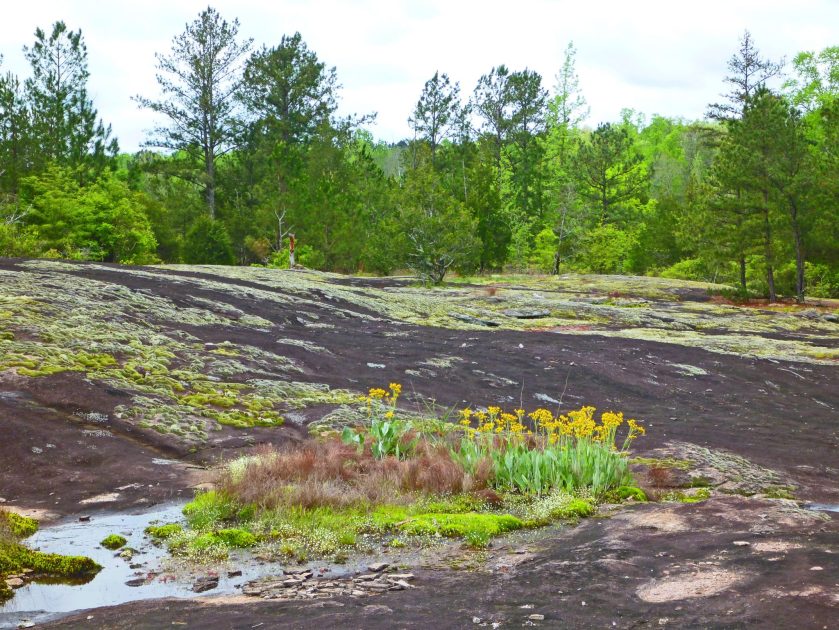

The seemingly endless expanse of rock was covered with vivid red patches of what I supposed to be sphagnum moss, but closer inspection revealed tiny aquatic plants with red leaves and even tinier white blossoms.


It was a blistering sunny day in central Alabama, and the rain dependent ephemeral pools were only inches deep. How was it possible for any aquatic plant to survive in a pool that was boiling hot, and couldn’t possibly exist for more than a few days before completely drying up?

After much research I determined that I had found Gratiola amphiantha, better known to no one as pool sprite or snorklewort. It is one of the rarest plants in the world, and is only found growing in tiny ephemeral pools atop granite.
When I visited the rock again in 2021 there was no sign of the Gratiola, it was probably in a dormant phase. I was dismayed to see that the place had been devastated by a tornado. On second thought I realized that was a good thing, since barrens need to be barren! The greatest threat to such an ecosystem (other than quarrying and assholes with ATVs) is for the site to be subsumed by shade trees, but all the trees had been flattened!

So it was that I decided to preach a sermon atop the rock. I thanked the nonexistent Almighty for her attention to small things, but blasted the Bitch for allowing a church to own the property rather than the Nature Conservancy.

And lo it came to pass! Now that the Great Bitch has sent us the Covid 19 Delta variant the vast majority of the dead or dying are unvaccinated fundamentalist Christian Republicans!
There was nothing left but the baptism. For that we headed to southwest Georgia where baptisms are more frequent than hygienic ablutions.
Anyone who knows Georgia will tell you that there are no waterfalls in southwest Georgia. It is best that they think that, so I’m not going to tell you the secret location!
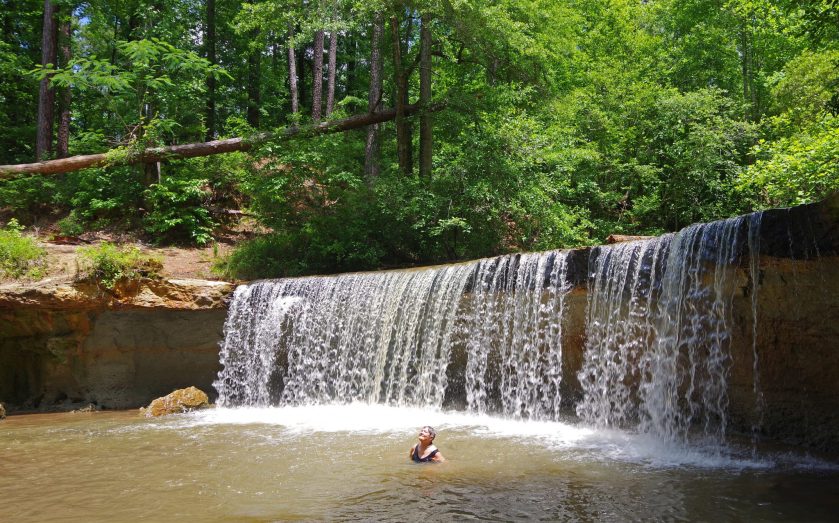

Having thus achieved both ablution and absolution we headed home.
………………………………………………………..
If you like waterfalls stay tuned! In the next installment of our thrilling adventure the Weazel journeys solo to the Chattooga river, land of waterfalls, a place where banjos play and men squeal like pigs!



Excellent, as usual. Thanks for this.
LikeLike
Thank you so much Ann & Weez. Glad you’er getting out-and-about.
cb
LikeLike
I wish I had been on this one. I have not seen my older brother Caleb in quite a few years.
I did not know he and is daughter were still sparkin’.
WV-Mike
LikeLike
Samuel and Mildred. Lucky them: thirty-eight years together. Bruce, your article was lovely and I could almost feel the cool air and mist from the waterfall. You do write expressively. Thank you for sending it. (However, I suspect that I had downloaded the articles from John’s phone.)
LikeLike